


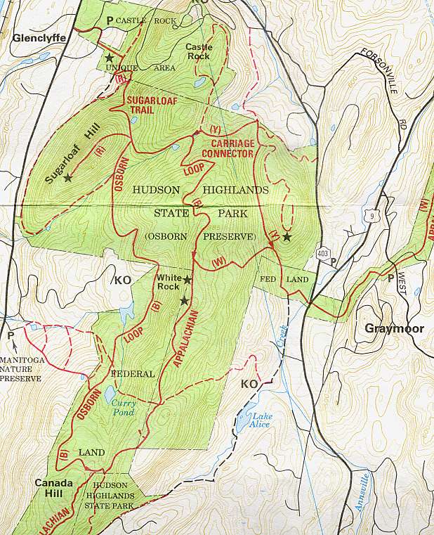
 The Appalachian Trail crosses US 9 at NY route 403, near the Graymoor monastery in Garrison. As the AT goes west from there, it takes one through Hudson Highlands State Park, and that's the hike I did this afternoon (see map at right, click to enlarge).
The trail goes off of route 403 on a raised, wooden path over a wetland field before heading into the woods. It ambles through the woods for a short time, ascending gently, and then the white rectangular AT blazes turn to the left and the trail begins to climb sharply up the hill (the yellow-blazed "carriage connector" continues straight, connecting to the blue "Osborn loop" trail, providing a less-steep way up to the ridge). It quickly climbs about 400 feet and turns south to go along the ridge for some distance, before dropping again to where it crosses South Mountain Pass Road.
I took it for a while to the south before returning and taking the blue and yellow trails down. There are a few places along the ridge (two marked with stars on the map) where one can find a nearby overlook to get some view of the Hudson River — though, really, this trail is better in the winter if you're looking for river views; the foliage blocks most of it now. And as the trail is lined with mountain laurel, it'll be time to go back there in six or eight weeks to see that show.
I stayed out for about two hours, which is what I'd planned. With more time, I'd have taken the blue trail over to Sugarloaf Hill, and gone up there — lovely views from that, at any time of year.


No comments:
Post a Comment